
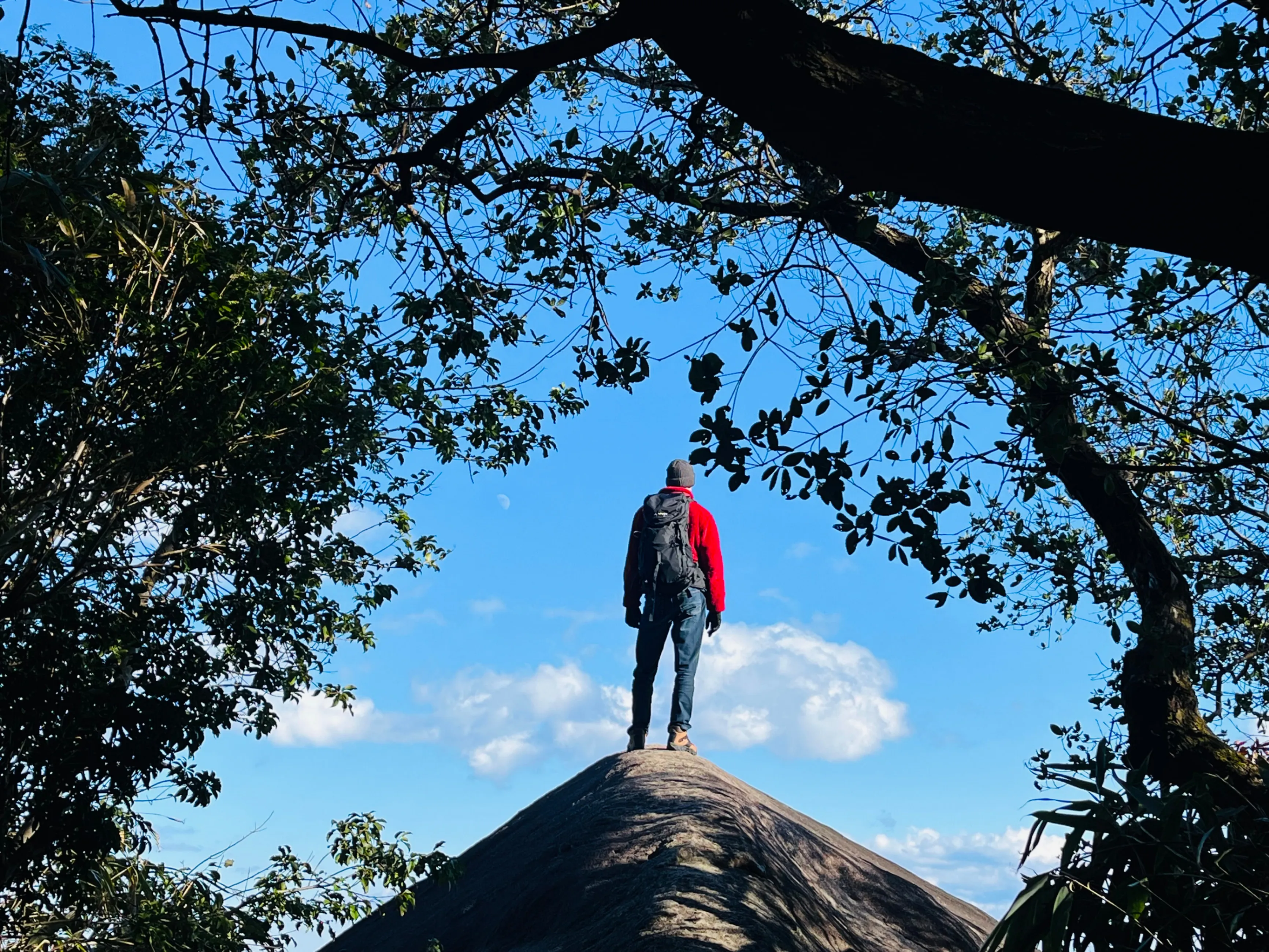
The summit of Mt. Binshiyama is surrounded by trees. There is no observation tower, triumphant clearing, or sudden coastal panorama—just a marker confirming that the 599-meter summit has been reached.
The real reward waits approximately five minutes farther along the clearly marked trail.
Known as the Elephant’s Back, this enormous bare rock projects from the forest above the boundary between Kihoku and Owase. Its central ridge extends outward and slightly upward before tapering toward its dramatic end. From the rock, hikers can look across a sweep of mountains, river, settlements, and sea that ranks among the most exhilarating views in Mie Prefecture.
MapZamurai
A View That Feels Like Floating
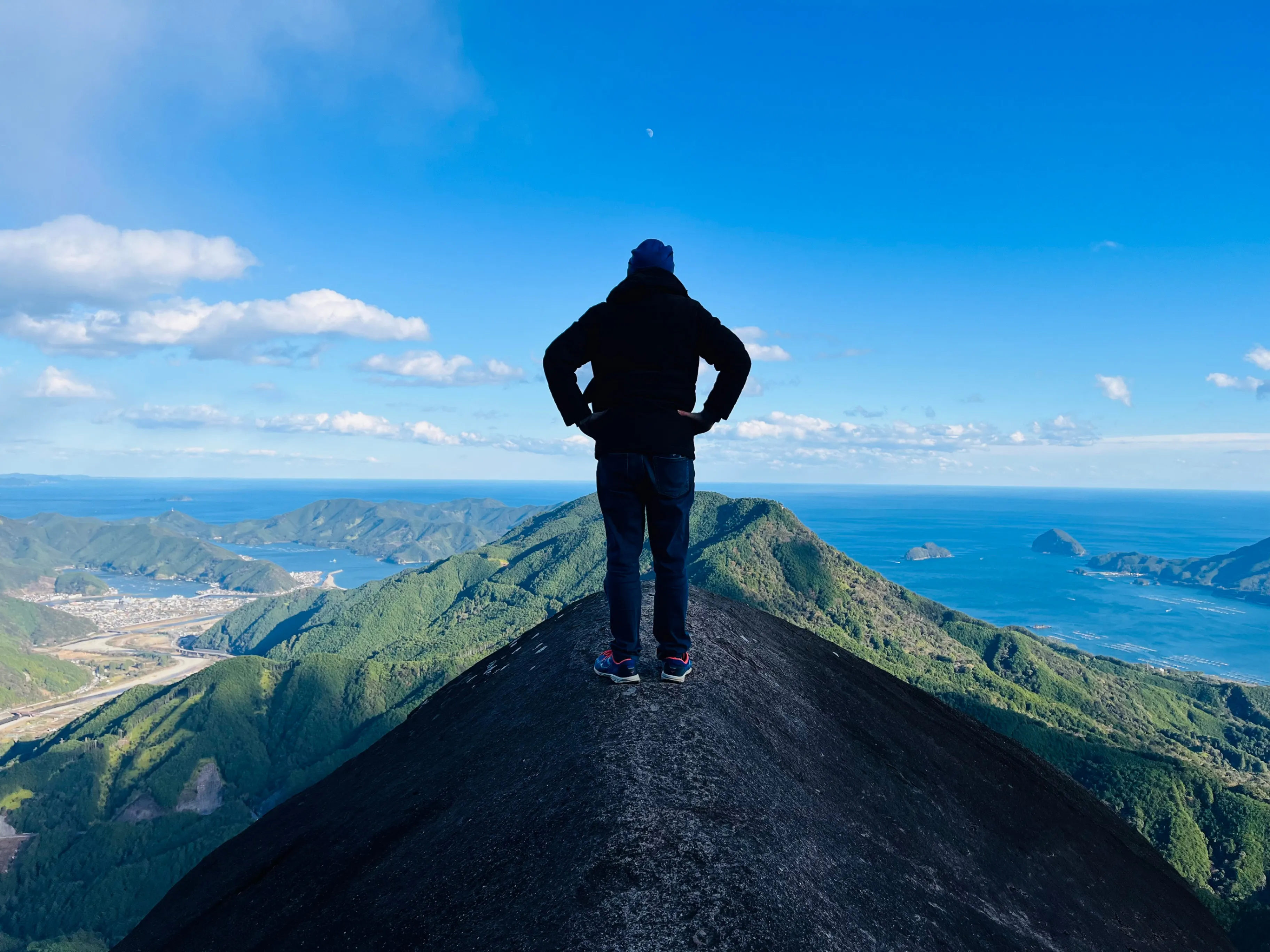
Approaching through the forest, the Elephant’s Back looks massive and unmistakably solid. That impression changes after stepping onto it. Because the rock largely disappears beneath the hiker’s field of vision, standing on its ridge creates the sensation of floating above the forest and valley.
The Choshi River and the parking area near Tanemaki Gonbe no Sato can be identified below. Aiga lies to the left and Owase spreads across the right side of the panorama. Mt. Tengurasan rises prominently near the center, with Kumano-nada and the wider Pacific forming the distant blue backdrop.
It is a view defined by opposing sensations. The open sky and enormous panorama create an instinctive desire to move outward into the scenery, while the narrow, exposed rock imposes an equally powerful awareness of physical limits. That tension between freedom and restraint is what makes the Elephant’s Back so memorable.
MapZamurai
The Direct Route from Tanemaki Gonbe no Sato
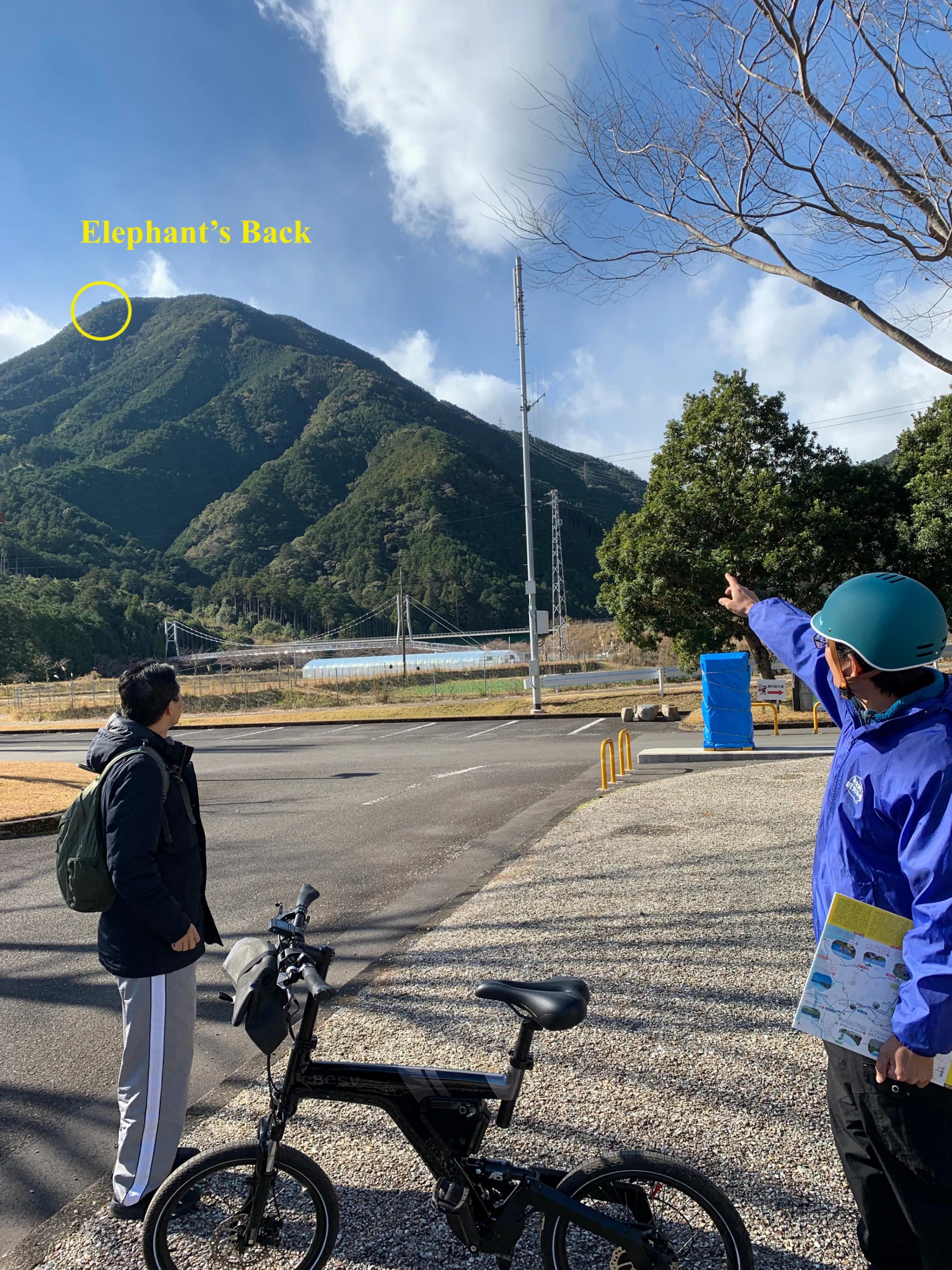
The most straightforward approach begins at Tanemaki Gonbe no Sato, a landscaped park and cultural facility beside the Choshi River. Its large parking area makes it a convenient base for the hike.
Current local guidance places the trail entrance about 20 minutes away on foot. The approach follows a quiet road toward Camp Inn Miyama, with a mixture of level and gradually rising sections.
Cycling turns this approach into an enjoyable part of the outing. Electric-assist bicycles are particularly useful on the uphill stretches, while the clear Choshi River provides scenery along the way. Near the trail entrance, bicycles can be locked in an open area beside the road, although this is not designated bicycle parking.
The return is especially rewarding. After completing the hike, cyclists can glide much of the way back toward Tanemaki Gonbe no Sato. Visitors without bicycles can walk from the parking area or arrange to be dropped closer to the trail entrance. Camp Inn Miyama may also offer parking under its own current conditions.
A Steep Beginning
A wooden sign marked 便石山 identifies the entrance beside a steep metal staircase. The staircase sets the tone immediately.
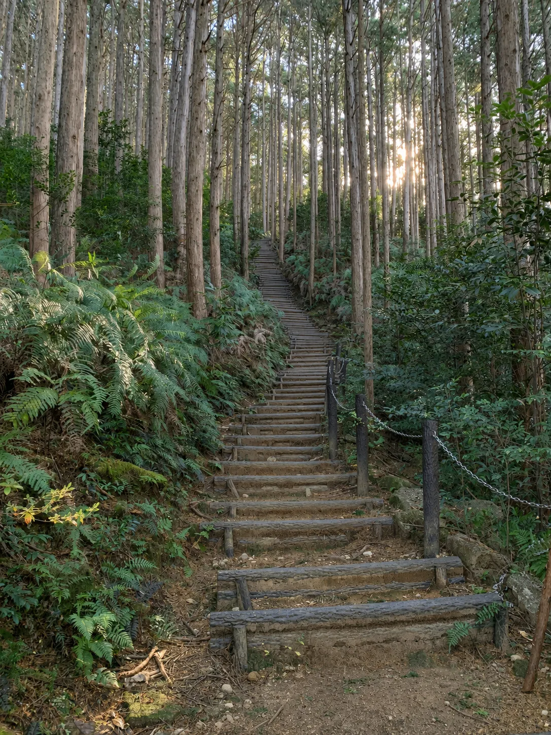
The lower portion is the most physically demanding part of the route. Steps, natural earth, and rocky terrain combine in a sustained ascent that can feel considerably tougher than an ordinary recreational walk. The climb is not highly technical, but it demands stamina and should not be approached as a casual stroll.
After most of the elevation has been gained, the trail becomes noticeably easier. The forest also changes character, becoming lighter near the top, with patches of bamboo and several branching paths. Signs make the route to both the summit and the Elephant’s Back easy to follow.
From the entrance near Camp Inn Miyama, the ascent typically takes around 90 to 100 minutes. Current regional guidance recommends allowing approximately four to five hours for the complete out-and-back route from Tanemaki Gonbe no Sato. Individual times depend on fitness, trail conditions, rest stops, and time spent at the viewpoint.
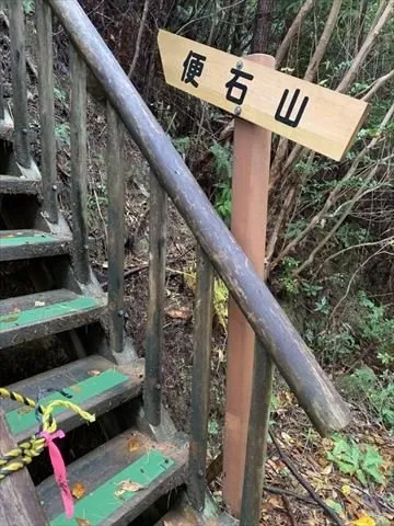
Photo source: FUN! JAPAN
Difficulty and Equipment
Mt. Binshiyama is best described as a moderately difficult mountain hike. High-top sneakers may be adequate in good, dry conditions, but hiking boots provide better grip and ankle support. Trekking poles are strongly recommended. They assist during the sustained climb and become even more valuable on the descent, which can be hard on the knees.
There are no toilets, drinking-water points, shelters, or formal rest areas along the mountain trail. Hikers should use the facilities near the parking area before departure and carry sufficient water. Light snacks may be enough for the direct route, while a bento can make sense for a longer itinerary or an extended break near the summit. All food and rubbish must be carried out.
Although there are no formal benches, steps and stable rocks offer places for short rests. Pausing regularly makes the climb more manageable and creates opportunities to appreciate the varied woodland and intermittent views.
This is a genuine mountain hike, not a simple walk in the park. It is unsuitable for small children and anyone whose health, pregnancy, mobility, stamina, or balance makes sustained steep climbing inappropriate. Older hikers with suitable fitness may still complete it, but should allow extra time and use trekking poles.
The Summit Before the View
The summit itself is surprisingly uneventful. Its forested setting offers little indication of the expansive scenery nearby, but the summit marker delivers more important news: the Elephant’s Back is only about five minutes away.
The final section passes through lighter forest with patches of bamboo and several paths. Clear signs direct hikers toward the viewpoint. Other openings between the trees provide glimpses of the surrounding landscape, but they remain secondary to what waits ahead.
The area immediately around the Elephant’s Back has enough open ground for a group to rest while individuals take turns on the rock. Additional waiting space can be found slightly farther back along the trail.
Stepping onto the Elephant’s Back
The Elephant’s Back emerges abruptly from the forest. Its clean, weathered surface rises like a stone backbone, free from much of the moss and vegetation covering the surrounding landscape.
There are no railings, ropes, barriers, or other protective features. A partial view can be enjoyed from the forest edge, but the full panorama opens after stepping onto the rock.
In dry and calm conditions, the central ridge provides better boot contact than its dramatic appearance might suggest. Its sides angle away from the ridge, however, and a loss of balance could have severe consequences. Even a gentle breeze heightens the sensation of exposure, while turning around can initially feel more daunting than walking forward.
Visitors should move slowly and allow only one person to stand on the rock at a time. A second person can join after the first has sat down, but two standing hikers could easily knock each other off balance.
Sitting transforms the experience. The need to balance recedes, and the exposed viewpoint can suddenly feel stable and peaceful. The rock should not be entered during strong winds, rain, ice, or any conditions that reduce traction or balance.
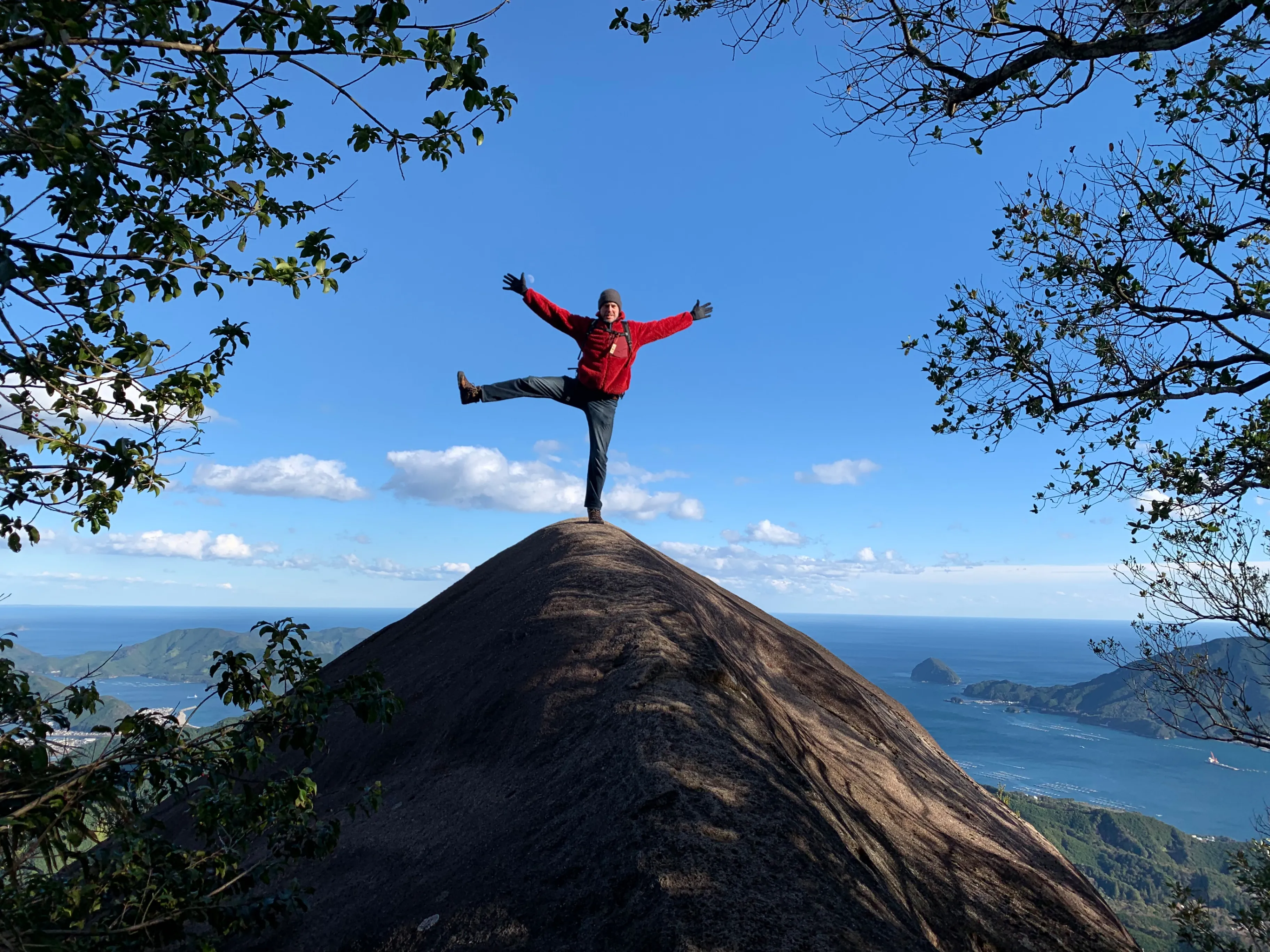
Photo by MapZamurai
Planning a Safe Hike
Mt. Binshiyama is best attempted with at least one companion. A partner provides support in case of injury or difficulty on the trail, helps manage the one-person-at-a-time approach to the exposed rock, and makes it possible to take photographs from solid ground.
Late autumn through winter can bring comfortable climbing temperatures and exceptionally clear views. Blue skies and crisp air make the geography of the Choshi River valley and coastline particularly easy to appreciate.
Winter also brings short daylight hours. Hikers should begin early, establish a firm turnaround time, and carry a headlamp even when expecting to finish before sunset. Before departure, check the current Mt. Binshiyama route information for access conditions, parking arrangements, and facility availability.
Mt. Binshiyama lies in black-bear habitat. Sightings and official advisories vary, so hikers should consult the latest Mie Prefecture bear information, carry a bear bell, and take appropriate precautions.
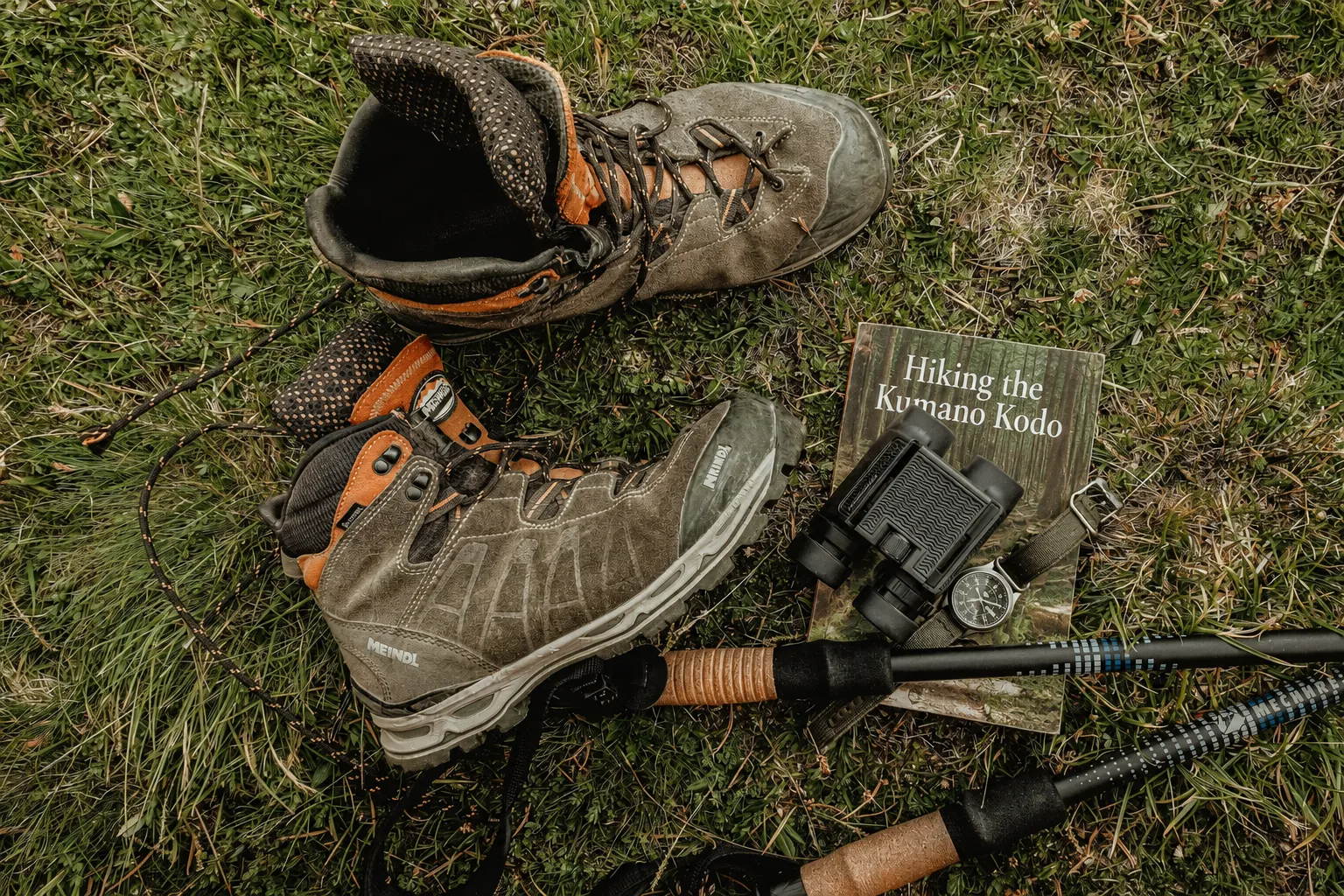
Photo by Jeremy Bishop on Unsplash. Modified from the original.
Magose-toge as an Alternative
Stronger hikers can approach Mt. Binshiyama from Magose-toge, part of the UNESCO-listed Kumano Kodo Iseji pilgrimage route. This option adds historic stone paving and the atmosphere of an ancient pilgrimage trail, but it also creates a longer and more demanding journey over steep, undulating terrain.
Magose-toge is therefore best treated as an alternative for experienced hikers or as an extension for those building a longer itinerary. Travelers primarily interested in reaching the Elephant’s Back will find the Camp Inn Miyama approach more direct.
The summit of Mt. Binshiyama may be understated, but that hardly matters. It serves as the final marker before the forest gives way to bare rock, an immense horizon, and the unforgettable sensation of standing in open air above the Kii Peninsula.
Frequently Asked Questions
How long does the Mt. Binshiyama hike take?
Allow approximately four to five hours for the out-and-back route from Tanemaki Gonbe no Sato. The climb from the trail entrance near Camp Inn Miyama typically takes around 90 to 100 minutes.
Is the Elephant’s Back safe to walk on?
The rock has no railings or barriers and is highly exposed. Its dry surface may be easier to walk on than expected, but a fall could have serious consequences. Visitors should move slowly, allow only one person to stand at a time, and remain off the rock during wind, rain, or ice.
Can beginners hike Mt. Binshiyama?
Fit beginners with suitable footwear, sufficient water, and adequate time may complete the direct route. However, the sustained steep ascent makes it considerably more demanding than a casual walk.
Are there toilets on Mt. Binshiyama?
There are no toilets along the mountain trail. Facilities are available near the Tanemaki Gonbe no Sato parking area during operating hours, but may be unavailable on closure days and holidays.
Is Mt. Binshiyama part of the Kumano Kodo?
Mt. Binshiyama is not itself part of the official pilgrimage route, but it can be reached as a demanding side trip from Magose-toge on the Kumano Kodo Iseji.